
The Desert
GeoPhoto: Geology Photography Spots in Kern County's Desert
Where to photograph Kern County's most striking rock formations, from the banded cliffs of Red Rock Canyon to the mining-era terrain of the El Paso Mountains.
Updated September 2026
Kern County’s northern Mojave Desert holds some of California’s most photogenic geology: banded sandstone cliffs, volcanic rock formations, and mining-era terrain that has drawn photographers and filmmakers for close to a century. This guide covers the real, current locations worth the drive rather than any specific tour program, since older references to a “GeoPhoto” name tied to Kern County tourism don’t correspond to any current, verifiable business or organized program, so consider GeoPhoto here a name for the destinations themselves, not a booked tour. What follows are the desert’s actual geological highlights.
GeoPhoto destination: Red Rock Canyon State Park
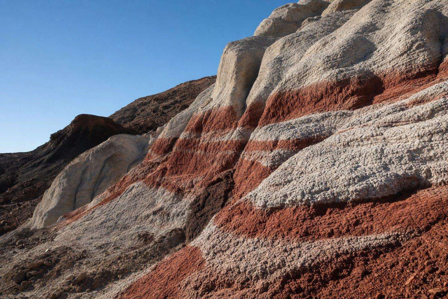
The single best-known geological photography destination in the county is Red Rock Canyon State Park, about 25 miles north of Mojave on Highway 14. Its tributary canyons are lined with alternating bands of white clay, red sandstone, pink volcanic rock, and dark lava, formed over roughly 3 million years, a landscape distinctive enough that it has served as a filming backdrop since the 1930s. Early morning and late afternoon light brings out the color contrast in the cliffs most dramatically, and the park’s short, largely undeveloped trails put photographers close to the rock without technical hiking. See our full Red Rock Canyon guide for park hours, camping, and access details.
El Paso Mountains
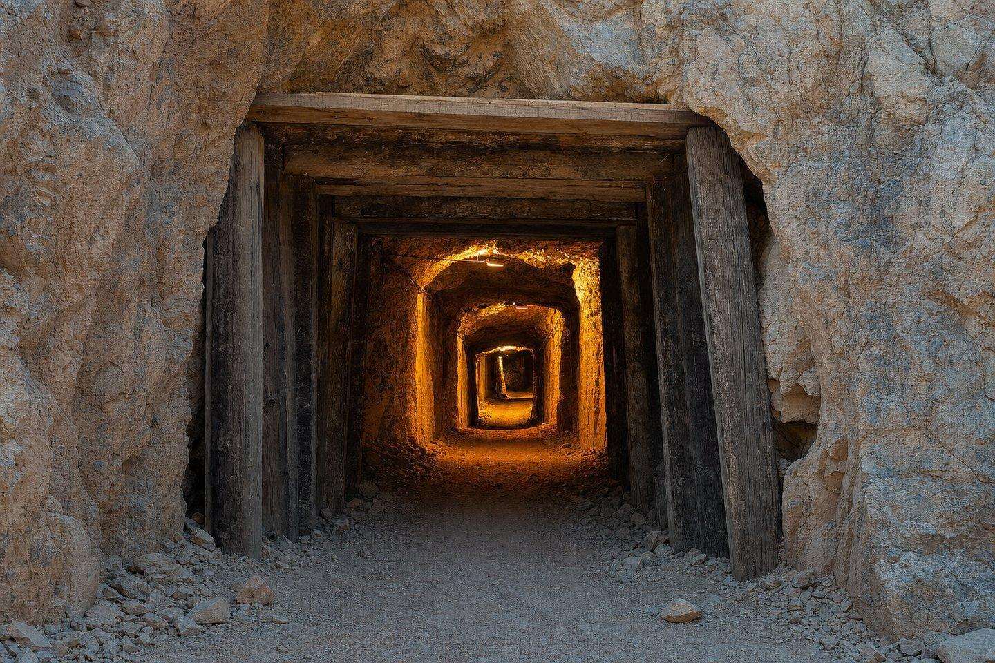
Just east of Red Rock Canyon, the El Paso Mountains offer a rougher, less-visited stretch of desert geology. The range is managed largely by the Bureau of Land Management and includes the El Paso Mountains Wilderness Area, along with the Last Chance Archaeological District. The Burro Schmidt Tunnel, a hand-dug mining tunnel bored through solid rock by a single miner between 1906 and 1938, is one of the more unusual man-made features to photograph here, with its tunnel opening framing a view down toward the abandoned mining settlement of Garlock. The surrounding mountains also hold rock carvings created by early indigenous inhabitants of the area, a reminder that this landscape has been documented, in one way or another, for far longer than photography has existed.
Randsburg and the Rand Mining District
South of the El Paso Mountains, the still-inhabited mining town of Randsburg sits amid the tailings, headframes, and weathered structures of the historic Rand Mining District, once home to one of California’s largest gold-mining operations. It’s less a natural-geology stop than a human-geology one (rusted equipment and mine scars set against stark desert hills) and pairs well with a stop at the small Rand Desert Museum for context before shooting.
Practical notes for desert photography
Anyone chasing GeoPhoto locations should know Kern County’s desert terrain rewards preparation more than almost any other part of the county. Summer heat routinely exceeds 100°F with little shade, making fall through spring the more comfortable (and often more photogenic) shooting season, since low-angle winter light tends to bring out texture in the rock that flatter midday summer light washes out. Cell service is unreliable or absent in most of these areas, roads range from paved highway to rough dirt track, and water, sun protection, and a full tank of gas are standard precautions before heading into any of these areas. Many of the more remote formations, including much of the El Paso Mountains backcountry, have no facilities at all, so a visit to Red Rock Canyon’s more developed park infrastructure is the easier starting point for a first trip into the region’s geology.
Frequently Asked Questions
What is 'GeoPhoto' in Kern County?
Older references to a 'GeoPhoto' name tied to Kern County tourism don't correspond to any current, verifiable business or organized program: treat it here as a name for the desert's real geological photography destinations, not a booked tour.
Where's the best geology photography in Kern County?
Red Rock Canyon State Park is the single best-known destination: its tributary canyons show alternating bands of white clay, red sandstone, pink volcanic rock, and dark lava formed over roughly 3 million years.
What's the Burro Schmidt Tunnel?
A hand-dug mining tunnel in the El Paso Mountains, bored through solid rock by a single miner between 1906 and 1938, one of the more unusual man-made photography subjects in the area, with its opening framing a view toward the abandoned settlement of Garlock.
Is Randsburg good for photography?
Yes, for human-geology subjects rather than natural formations: the still-inhabited mining town sits amid real tailings, headframes, and weathered structures from the historic Rand Mining District.
When is the best light for desert rock photography?
Early morning and late afternoon, when low-angle light brings out color contrast and texture in the rock most dramatically. Flat midday summer light washes out the same detail.