
The Mountains
The Tehachapi Loop: A World-Famous Railroad Spiral in Kern County
Near Tehachapi, a Southern Pacific spiral track climbs over itself to gain elevation through Tehachapi Pass: a 150-year-old landmark still in daily freight use.
Updated September 2026
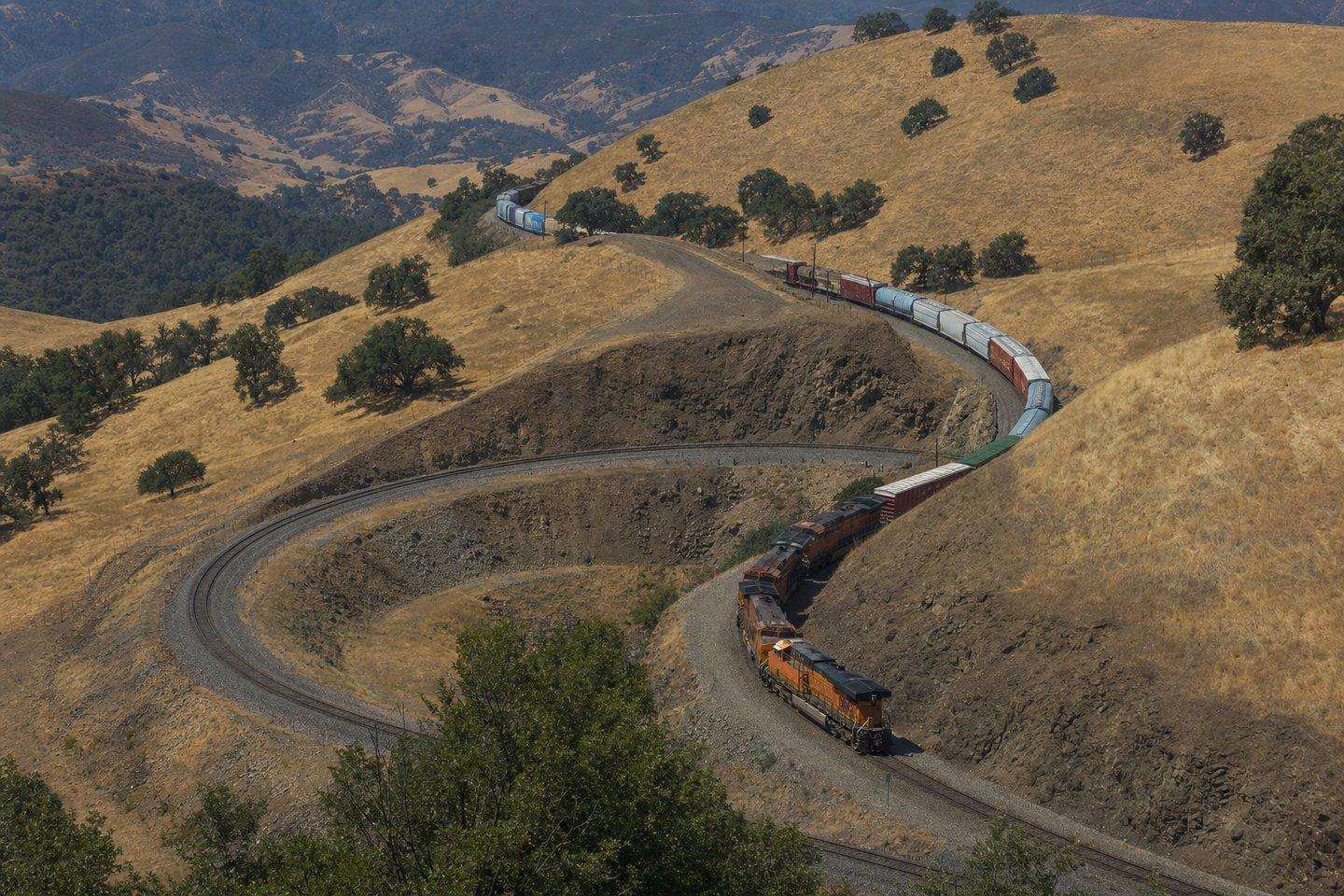
A few miles northeast of the town of Tehachapi, a stretch of railroad track does something unusual: it climbs a mountain grade by looping over the top of itself. Long trains crossing the pass pass directly above their own rear cars as they spiral upward. It’s called the Tehachapi Loop, and it’s one of the most studied pieces of railroad engineering in the United States: a working landmark that still carries dozens of freight trains a day, more than a century and a half after it was built.
Why the Tehachapi Loop exists
Tehachapi Pass connects the San Joaquin Valley floor to the high desert beyond, and the elevation change is steep enough that a straight route would have required a grade too aggressive for 19th-century steam locomotives to climb safely. Rather than blast a more direct path, Southern Pacific’s engineers designed a spiral: the track curves back around and crosses over itself on a bridge, gaining elevation gradually while looping through a full 360 degrees.
The loop itself is about 3,779 feet of track (a little under three-quarters of a mile) wrapped into a circle roughly 1,210 feet across. In completing that full loop, a train gains 77 feet of elevation on a steady grade of a little over 2 percent. At the bottom of the loop, the track passes through a tunnel (Tunnel 9) before emerging to cross over the track it just traveled on. Any train longer than about 3,800 feet (roughly 56 boxcars) will have its engines pass directly above its own rear cars while still climbing.
Built by hand, in under two years
Construction began in 1874 and the line opened in 1876, under Southern Pacific chief engineer William Hood and civil engineer James R. Strobridge. The work was done almost entirely by hand: an estimated 3,000 Chinese laborers spent 1875 and 1876 cutting the grade with picks, shovels, horse-drawn carts, and blasting powder, part of the same Southern Pacific labor force that had earlier helped build the transcontinental railroad through the Sierra Nevada. The loop is one piece of a much longer engineering effort through the pass: the full Tehachapi line includes 18 tunnels and 10 bridges in total.
Still a working railroad, not a museum piece
Unlike many 19th-century engineering curiosities, the Tehachapi Loop isn’t preserved as a static site. It’s an active, heavily used freight corridor. Union Pacific, which absorbed Southern Pacific in a 1996 merger, owns the line; BNSF Railway also runs trains over it under trackage rights. Between the two railroads, the pass sees dozens of freight trains daily. There’s no scheduled passenger service across the loop (Amtrak’s Coast Starlight uses it only as an emergency detour), which means the trains a visitor sees here are genuinely working freight, often stretching well past the length needed to see an engine crossing over its own tail end.
The line has been modernized without changing its basic 1876 geometry: upgrades in the 1990s made it possible to run double-stack intermodal container trains through the original tunnels, and further work between roughly 2013 and 2020 added double-track segments and improved sidings to handle modern traffic volumes.
Because of both its age and its continued active use, the Tehachapi Loop was named a National Historic Civil Engineering Landmark in 1998 and is also California Historical Landmark No. 508.
Where to watch it
The most established viewing spot is a scenic overlook on Woodford-Tehachapi Road, where a concrete viewing platform was built in the summer of 2021 specifically for visitors and railfans. From the overlook, on a good day, it’s possible to watch a single long freight train visible on multiple levels of the loop at once: climbing into view, curving back on itself, and crossing over a section of track it passed only minutes earlier. Because train timing isn’t published or predictable, patience helps; some visitors plan a couple of hours, bring water and shade, and treat a train sighting as a bonus rather than a guarantee. The Tehachapi Depot Railroad Museum, housed in the town’s original 1904 Southern Pacific depot, is a good complementary stop for background on the line’s history before or after visiting the overlook.
The wind farms next door
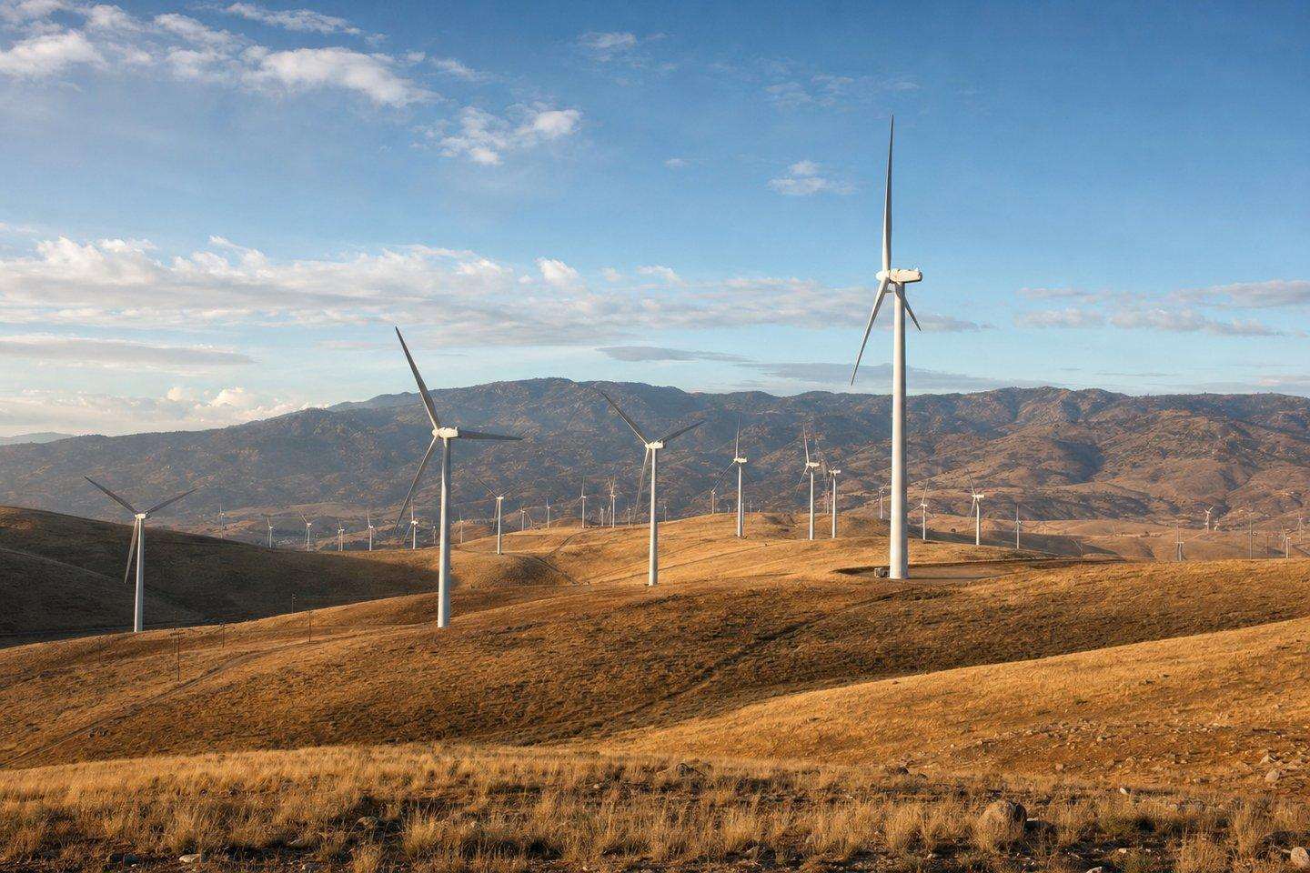
Tehachapi Pass is also home to one of the country’s earliest large-scale wind-energy developments, and the two landmarks pair naturally on the same trip: the same mountain gap that made the pass a railroad chokepoint also funnels wind between the San Joaquin Valley and the Mojave Desert, creating a natural wind corridor.
Commercial wind development in the pass began in the early 1980s, led by engineer James Dehlsen and his company, Zond Corporation, making it one of the first places in the U.S. to install wind turbines at scale. Early American-built turbines proved unreliable and were gradually replaced with more dependable Danish-built machines; today’s turbines in the pass can generate up to several megawatts each, a dramatic jump from the kilowatt-scale machines of the 1980s. The original Tehachapi Pass wind resource area alone is estimated to host on the order of 3,400 turbines across thousands of acres, producing roughly 710 megawatts, and the region as a whole is a net exporter of electricity to the rest of California.
The pass has continued to grow as a wind-energy center in the decades since. The Alta Wind Energy Center, built in phases between 2010 and 2014 just outside Tehachapi, added a combined capacity of about 1,550 megawatts from 600 turbines, for a time one of the largest wind farms in the country. Together, the older Tehachapi Pass turbines and the newer Alta complex make the pass one of California’s most visually striking wind-energy landscapes: ridgelines lined with turbines of several different generations, visible from Highway 58 as it climbs through the pass. Our Tehachapi wind farms deep-dive covers the pioneering 1980s history behind those older turbines.
Planning a visit
Both landmarks sit close enough to Highway 58 and the town of Tehachapi to combine into a single loop drive: the railroad overlook, a pass through the wind turbine ridgelines, and a stop in town for the railroad museum or a meal. Because the loop overlook has no facilities beyond the viewing platform itself, it’s worth fueling up and using restrooms in Tehachapi before heading out, and checking road conditions in winter, since the pass sits at elevation and occasionally sees snow.
Frequently Asked Questions
What is the Tehachapi Loop?
A stretch of railroad track near Tehachapi that gains elevation through Tehachapi Pass by looping over itself in a full 360-degree spiral: about 3,779 feet of track wrapped into a circle roughly 1,210 feet across, gaining 77 feet of elevation.
When was the Tehachapi Loop built?
Construction began in 1874 and the line opened in 1876, under Southern Pacific chief engineer William Hood, built largely by an estimated 3,000 Chinese laborers.
Is the Tehachapi Loop still used today?
Yes, it's an active freight corridor owned by Union Pacific, with BNSF Railway also running trains under trackage rights. Dozens of freight trains cross the pass daily; there's no scheduled passenger service.
Where can I watch trains on the Tehachapi Loop?
A concrete viewing platform on Woodford-Tehachapi Road, built in 2021 specifically for visitors, is the most established spot. Train timing isn't published, so patience helps.
Are the Tehachapi wind farms near the railroad loop?
Yes, the same mountain gap that made the pass a railroad chokepoint also creates a natural wind corridor. Commercial wind development began there in the early 1980s, and the pass remains one of California's most visually striking wind-energy landscapes.